A Schmidt hammer and laser scanner are the first tools out of the truck on a Hamilton slope assessment. The Niagara Escarpment runs right through the city, shaping everything from residential lots in Waterdown to industrial parcels near the harbour. Slope stability analysis here means dealing with the Lockport dolostone caprock overlying weaker Rochester shale—a stratigraphic recipe for block falls and rotational slides. Our team runs limit equilibrium modeling with Slide2 and RocPlane, factoring in the 100-meter relief differentials common along the Mountain Brow. We pair field mapping with test pits to verify overburden thickness where the escarpment transitions into glacial till, giving you a complete picture before any foundation or retaining structure goes in.
Hamilton's escarpment geology demands analysis that accounts for both dolostone caprock stability and the weaker shale layers beneath—ignoring either one leads to failure.
Methodology applied in Hamilton
Typical technical challenges in Hamilton
Hamilton recorded a 5.0 magnitude earthquake in 1998 near the escarpment, a reminder that Southern Ontario isn't seismically quiet. The combination of weathered shale, groundwater infiltration, and even moderate shaking can trigger slope failures with serious consequences—property loss on the Mountain Brow, road closures along the 403, and sediment loading into Cootes Paradise. Red Hill Valley Parkway cuts through terrain with documented landslide history, and several residential streets along the escarpment face active erosion zones. Without a site-specific stability assessment, you're relying on assumptions that don't account for local joint patterns or the effect of a saturated winter thaw cycle on Rochester shale. The cost of remediation after failure dwarfs the investment in analysis beforehand.
Our services
Our slope stability work in Hamilton covers the full project lifecycle—from preliminary desktop studies through detailed design and construction-phase monitoring. Here's what we deliver:
Escarpment Stability Assessments
Kinematic and limit equilibrium analysis for properties along the Niagara Escarpment, including joint survey mapping and rockfall hazard rating per Ontario guidelines.
Embankment and Cut Slope Design
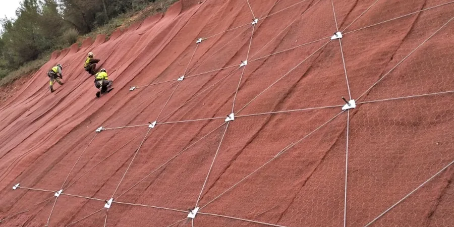
Stabilization design for highway cuts, residential benching, and industrial earthworks using reinforced soil, drainage systems, and regrading strategies.
Forensic Slope Failure Investigation
Root cause analysis for active landslides, including instrumentation data review, back-analysis of shear strength, and remediation recommendation reports.
Frequently asked questions
What triggers a slope stability analysis requirement in Hamilton?
Most triggers come from the Niagara Escarpment Commission development permit process, Ontario Building Code requirements for structures within setback zones, or conditions attached to site plan approvals near the Mountain Brow. Any proposed construction within 15 meters of the escarpment top-of-slope typically requires a geotechnical stability report signed by a licensed engineer.
How much does a slope stability analysis cost in Hamilton?
For Hamilton projects, budget between CA$1,870 for a desktop-level assessment of a straightforward cut slope and up to CA$5,990 for a full escarpment analysis with field mapping, kinematic modeling, and remediation design. The spread depends on access difficulty, required modeling complexity, and whether lab shear strength testing on recovered core samples is needed.
How long does a typical slope stability assessment take?
A standard assessment runs three to four weeks: one week for field mapping and data collection, one week for lab testing if rock cores or soil samples are required, and one to two weeks for modeling and report preparation. Complex sites with multiple failure modes or requested remediation alternatives may extend the timeline by a week.