Hamilton's geotechnical profile shifts dramatically within a few kilometers—from the fractured shale of the Niagara Escarpment to the compressible glaciolacustrine clays near the harbour. When an excavation cuts through these transitions, the monitoring strategy has to adapt in real time, not just follow a generic checklist. The city sits at the western tip of Lake Ontario, where the Iroquois shoreline deposits create perched water tables that complicate even modest basement digs. Our team has instrumented cuts ranging from 4 meters in Stoney Creek to 25-meter deep excavations downtown, and the one constant is that CPT testing data alone won’t capture the full picture unless it’s paired with continuous inclinometer arrays and piezometer nests that track pore pressure response during dewatering. Hamilton’s winter freeze-thaw cycles add another layer: we’ve measured lateral displacements accelerating by 30% during March thaws when the upper 2 meters of clay lose suction, so monitoring schedules here have to account for seasonal behaviour that standard specifications often overlook.
In Hamilton’s escarpment terrain, the difference between a stable excavation and a failing one often shows up first in piezometer readings, not in deformation data—pore pressure tells you what’s coming.
Methodology applied in Hamilton
Typical technical challenges in Hamilton
A 15-storey condominium project on King Street East ran into trouble when the excavation reached 9 meters and inclinometer readings showed 18 mm of lateral movement overnight—the contractor had assumed the Halton Till would behave as a cohesive unit, but a 300 mm lens of water-bearing sand at the 7-meter level had gone undetected during the initial site investigation. The shoring system was designed for a uniform soil profile, and that thin sand layer created a preferential drainage path that reduced effective stress along the entire east wall. We had to implement a supplementary wellpoint dewatering ring within 72 hours while the structural engineer redesigned the waler spacing to account for the revised earth pressure distribution. This is exactly the scenario where monitoring data becomes the decision-making backbone: without real-time piezometer and inclinometer correlation, the movement could have progressed to a basal failure before anyone on site recognized the pattern. Hamilton’s geological history—glacial lake deposits overlying fractured bedrock—creates these hidden interfaces more often than most geotechnical reports anticipate, which is why our monitoring protocols always include contingency trigger levels calibrated to the specific stratigraphy encountered in the first week of excavation.
Our services
Our Hamilton excavation monitoring programs are built around the specific geological transitions that define this region. Each service integrates instrumentation selection, installation QA/QC, and data interpretation by geotechnical engineers who understand the Niagara Escarpment's behaviour.
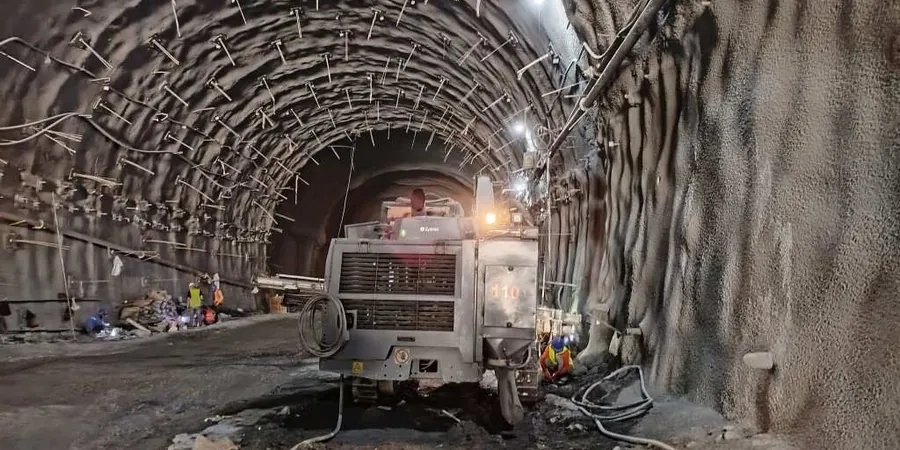
Inclinometer and Shape Array Installation
Vertical and horizontal inclinometer casings grouted into boreholes extending at least 3 meters below the predicted failure surface. We use dual-axis MEMS probes with automated data logging for projects requiring hourly readings, and manual traversing probes for weekly verification cycles.
Vibrating Wire Piezometer Networks
Multi-level piezometer installations targeting specific hydrostratigraphic units—we typically place sensors above and below the Halton Till–Queenston shale contact, and within any sand lenses identified during drilling. Barometric compensation and temperature correction are applied to all datasets.
Surface and Subsurface Settlement Monitoring
Deep settlement rods anchored in competent bedrock combined with surface arrays referenced to stable benchmarks outside the zone of influence. We use digital levels with 0.3 mm closure accuracy and establish baseline readings over a minimum 7-day pre-excavation period.
Vibration and Crack Monitoring for Adjacent Structures
Triaxial geophones mounted on building foundations within 30 meters of the excavation, with continuous waveform recording and PPV analysis. Crack gauges installed on pre-surveyed fractures provide complementary displacement data for heritage structure assessments.
Frequently asked questions
How much does geotechnical excavation monitoring cost for a typical project in Hamilton?
Monitoring programs in Hamilton generally range from CA$1,000 to CA$3,500 depending on the excavation depth, number of instrument types required, and duration. A basic program for a residential basement excavation (two inclinometers, four settlement markers, monthly readings over 60 days) falls at the lower end. A comprehensive program for a 15-meter downtown excavation with automated inclinometers, multi-level piezometers, vibration monitoring, and daily reporting for six months reaches the upper end. We provide detailed proposals after reviewing the shoring design and geotechnical baseline report.
What monitoring frequency is required during excavation in Hamilton's escarpment areas?
During active excavation within the Niagara Escarpment zone, we recommend daily inclinometer and piezometer readings when the cut is within 2 meters of the design depth. The fractured Queenston shale can exhibit rapid block relaxation, and pore pressure changes often precede measurable deformation by 12 to 24 hours. Once the permanent support system is installed and backfilling begins, the frequency typically reduces to weekly readings for a 30-day stabilization period, then monthly for the remaining monitoring duration per OPSS 206 requirements.
What instrumentation is mandatory for deep excavations near heritage buildings in downtown Hamilton?
Projects adjacent to designated heritage properties on streets like James North or MacNab require crack gauges on all existing fractures within the zone of influence, triaxial vibration monitors set to a 5 mm/s PPV alarm threshold, and automated inclinometers with SMS alert capability. Ontario Regulation 385/21 also requires pre-construction condition surveys with photographic documentation and baseline settlement readings over a minimum 14-day period before any excavation begins.
How do you handle monitoring when unexpected groundwater conditions are encountered during excavation?
When perched water or artesian conditions appear that weren’t identified in the pre-construction investigation, we immediately install supplementary standpipe or vibrating wire piezometers at the new seepage horizons and adjust the monitoring frequency to hourly readings for 48 hours. This data feeds directly into a revised pore pressure model that the shoring designer uses to verify the wall’s factor of safety. In Hamilton’s harbour-adjacent zones, where the Iroquois shoreline deposits create complex groundwater regimes, we’ve had to deploy wellpoint systems within 72 hours of detecting elevated pressures, and the piezometer data confirmed stabilization before any structural distress developed.