The seismic cone trucks we mobilize around Hamilton carry a triaxial geophone and a high-resolution data acquisition system. It is a setup built for urban logistics. Tight access in the lower city. Variable fill over the Queenston Shale.
The equipment pushes through glacial Lake Iroquois deposits that blanket much of the region. We pair the CPTu sounding with downhole shear-wave velocity measurements at 1.5-meter intervals. This isn't a desktop exercise. It's ground-truthed site response, calibrated against the CPT test refusal depth at the shale contact. The resulting Vs profiles feed directly into the NBCC 2020 site classification framework. For sites near the escarpment face, we also integrate data from deep excavations to capture edge effects that one-dimensional profiles often miss.
Hamilton's site response is governed by the sharp impedance contrast between soft lakebed clays and the underlying Queenston Shale.
Methodology applied in Hamilton
Our field program reflects this split. On the mountain we run short MASW arrays with a 48-channel seismograph. In the lower city we switch to longer spreads and deeper active-source lines. The dynamic properties of the Lake Iroquois clay are the wildcard. Its plasticity index runs high, which influences modulus reduction curves. We extract undisturbed Shelby tube samples for resonant column testing to anchor the model. This local calibration is essential because the standard NEHRP curves were developed for soils that do not match our post-glacial stratigraphy.
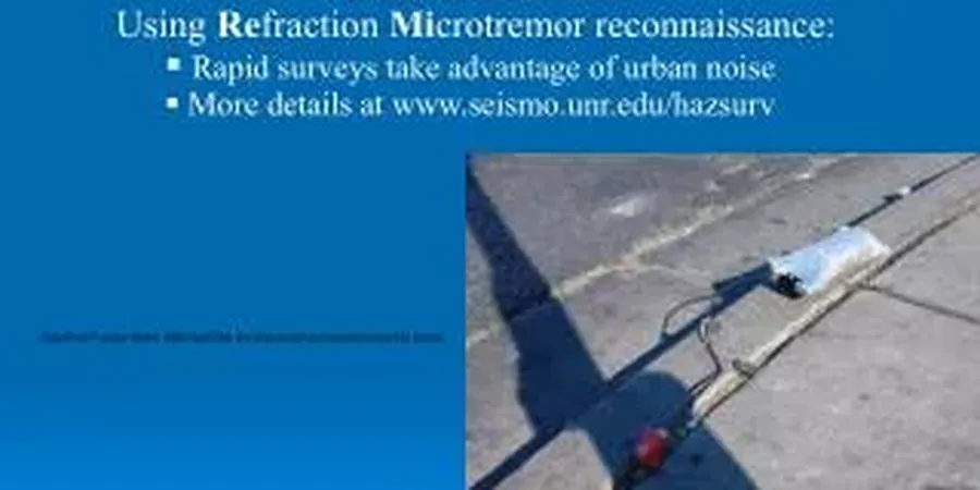
Demonstration video
Typical technical challenges in Hamilton
Hamilton's industrial east end grew on reclaimed land and unengineered fill. The historical shoreline of Lake Ontario was pushed out with slag, ash, and dredged material. No thought was given to seismic performance. A microzonation study across these sectors often reveals lateral spreads in fill and a high liquefaction susceptibility in loose hydraulic sands buried under the post-industrial cover. The 2020 NBCC now requires explicit consideration of Site Class F where quick clays or liquefiable soils exceed three meters in thickness.
Ignoring this isn't an option for structural design. A building assigned to Site Class C on a cursory look may actually sit on a Class E profile once the shear-wave data are processed. The consequence is a design spectrum that underestimates the plateau acceleration by forty percent or more. That gap translates directly into under-designed lateral systems.
Our services
The microzonation workflow in Hamilton is structured as a tiered investigation. Each phase builds on the previous one, moving from regional screening to site-specific analysis.
Vs30 Mapping and Site Class Delineation
Grid-based MASW and passive-source arrays to produce a continuous Vs30 map. We correlate surface wave data with deep borehole logs to handle velocity inversions common in the Barton Street corridor.
Ground Motion Amplification Analysis
One-dimensional equivalent-linear site response using DEEPSOIL or SHAKE. We use laboratory-derived G/Gmax and damping curves from local Lake Iroquois clay samples, not generic models.
Liquefaction Hazard Microzonation
CPT-based triggering analysis following the Boulanger & Idriss (2014) procedure. Factor of safety maps at 2-meter depth intervals, integrated with the LPI and LSN indices for the Hamilton port lands.
Frequently asked questions
What is the typical cost range for a seismic microzonation study in Hamilton?
Depending on the number of measurement points and the depth of investigation, a Hamilton microzonation study typically ranges from CA$5.410 for a single-site classification to CA$21.720 for a multi-hectare grid with full site response analysis.
How does the Niagara Escarpment affect seismic site response in Hamilton?
The escarpment creates a topographic amplification effect. Our field measurements show ground motion increases of 20 to 30 percent within 100 meters of the brow. We model this with two-dimensional finite element profiles.
Which NBCC site class applies to the Hamilton harbour area?
Most of the harbour and lower city falls into Site Class D or E. The deep soft clays deposited by Lake Iroquois produce average shear-wave velocities below 180 m/s in the upper 30 meters. A site-specific measurement is required because the boundary between Class E and F depends on the clay sensitivity.
How long does a microzonation field campaign take for a typical Hamilton site?
For a standard commercial lot, field work is completed in one to two days. We mobilize the seismic CPT truck and the MASW array in the same window. Processing and reporting take an additional two weeks, including the site response runs.